
City of Cork Civic Survey Maps
TitleCity of Cork Civic Survey Maps
ReferenceCP/AR/CS/1
Date
August 1924
Production date 1924 - 1924
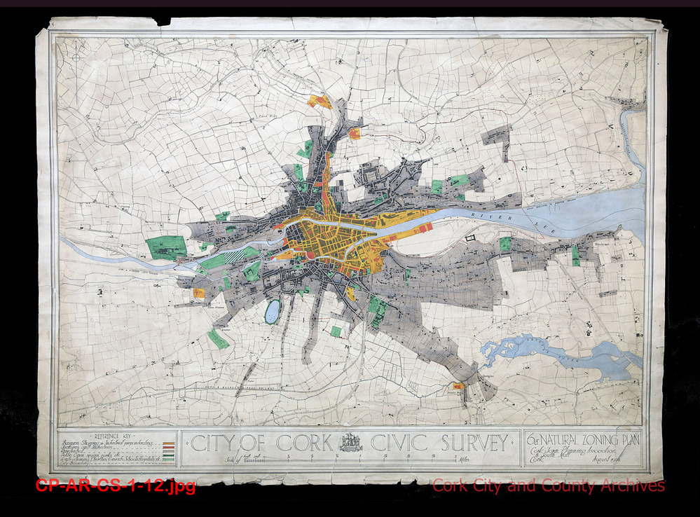
Scope and ContentGraphical map series of Cork city, with hand-coloured annotations representing key statistical information in respect of town planning in Cork. Maps include annotations depicting rail and tram transport routes, movement of cattle to market, ground gradient contours, population densities, and locations of public buildings such as fire stations, churches, and schools. The maps also depict industrial and commercial zones in the city such as food markets and bond warehouses. The original map numbers are recorded in the title of each map description in square brackets.
Extent15 items
AccessHard copies: Accessible to Readers by appointment. Access restrictions apply to some collections. Digital object/copy: see Download Media and/or Digital Reference
RightsLicensing information available on request by email to archivist@corkcity.ie Copyright Cork City and County Archives, Cork City Council, unless otherwise indicated. All Rights Reserved.
Levelsub-series
Digital reference
Object categoryMaps, Plans and Drawings
Download media