
Wide Streets Commissioners Maps, Plans and Drawings
TitleWide Streets Commissioners Maps, Plans and Drawings
ReferenceWSC/A
Date
c1820- 1850s (1872)
Production date 1820 - 1872
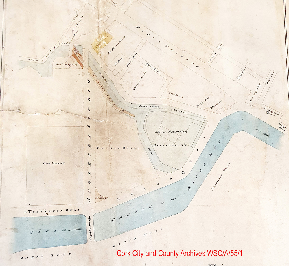
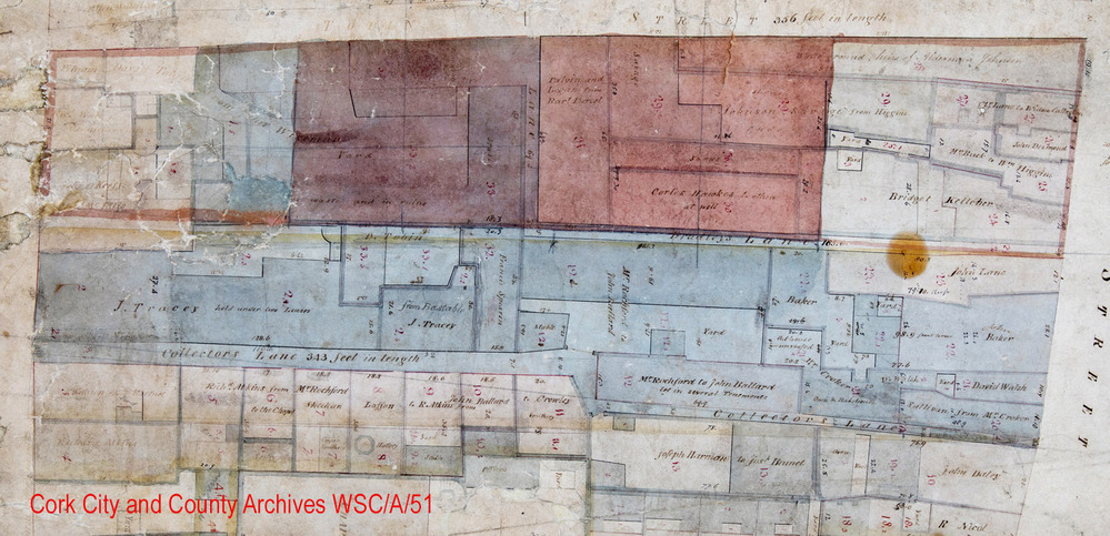
Scope and ContentMaps, Plans and Drawings of the Cork Wide Street Commissioners. Mainly pen and ink map area surveys relating to work of the Commissioners in various sections of the City where the widening or improvement of streets is proposed. Level of map detail varies, but often shows names of property owners, details about structures such as lime kilns, stores, mills are given. Most are drawn to scale.
Locations include, for example, Globe Lane, Corn Market Street, Mannix Street, Union Quay, Watercourse Road, Sunday's Well, South Terrace, North Main Street, South Main Street, Shandon, The Lough, Spring Lane, Mulgrave Street, South Mall,
Names/signatures/surveyors include, for example, A. Klein, Patrick Aher, Michael Deasy, James Wherland, Robert Walker, Alexander Deane, Richard R. Brach, CW Lane, John Hoare.
Extent81 drawings
Persons keywordCork Wide Streets Commissioners
SubjectWide Streets Commissioners
AccessHard copies: Accessible to Readers by appointment. Access restrictions apply to some collections. Digital object/copy: see Download Media and/or Digital Reference
RightsLicensing information available on request by email to archivist@corkcity.ie Copyright Cork City and County Archives, Cork City Council, unless otherwise indicated. All Rights Reserved.
Levelseries
RepositoryCork City and County Archives
Object categoryMaps, Plans and Drawings


Download media