
Longfield Castlemary Estate Valuation Survey
TitleLongfield Castlemary Estate Valuation Survey
ReferenceIE 627/U750
Date
1865
Production date 1865 - 1865
Scope and ContentSurvey of Montifort/Mountiford Longfield 'Castlemary' estate in East Cork and other areas, by Hodges Smith and Co. Map Agency Office, 104 Grafton Street, Dublin.
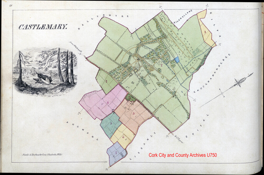
Describes the estate of approx. 75 townlands with accompanying townland maps, mainly in the Baronies of Imokilly and East Muskerry, with some also in West Carbery Eastern and Western Divisions in County Cork, and one property in Magunihy in Kerry. Civil parishes include Kilbonane, Rostellan, Aghada, Cloynes, Inch, Mogeely, Ballintemple, Corkbeg, Dungandonovan, Killarney, Ightermurragh, Garranekinnefeake, Midleton, Ballyoughtera, Kilmahon, Youghal, Skull, Cannaway, Inchigeela, Dungourney, KIlmahon. The total acreage is Irish measure 12,051/ English measure 19,522 acres. Total valuation of land is £12,194 and houses £2,411. Each townland is mapped out in detail, showing buildings, giving occupiers' names, the acreage of each occupier's holding, the valuation of each holding, plus descriptions and observations such as 'House Offices and Land', or 'Houses Smithy and Garden', or 'Corn and Tuck Mill' (townland of Kilmore, p19). The maps are at a scale of 6 inch to one mile and appear to be derived from Ordnance Survey maps.
The main estate 'big house' was at Castlemary, parish of Inch, in Imokilly, where the Longfields occupied 587 acres.
Extent1 vol. c250pp
Persons keywordLongfields of Castlemary
SubjectLanded Estate Papers
AccessHard copies: Accessible to Readers by appointment. Access restrictions apply to some collections. Digital object/copy: see Download Media and/or Digital Reference
RightsLicensing information available on request by email to archivist@corkcity.ie Copyright Cork City and County Archives, Cork City Council, unless otherwise indicated. All Rights Reserved.
Levelfonds
Object categoryLanded Estate Papers
Download media